The cove on paper

Old Maps of Widow’s Hole

Surveyors, atlas publishers and the government’s chartmakers have been drawing this little cove for a century and a half. Two documents from the collection, and where to find the rest.

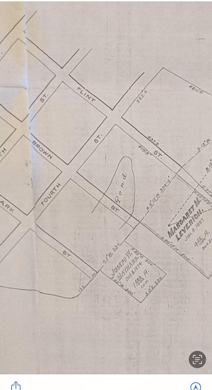
Detail of an 1887 bottom-land grant map of Greenport showing the pond and the parcel of Margaret M. Leverich
1887 — A bottom-land grant map of the Greenport shore. At the center, the brackish pond behind the point; at right, the parcel marked Margaret M. Leverich — the widow of the cove’s name, still on the map fifty years after her captain sailed. Brown, Clark and Fourth Streets are all drawn, already running down to the water.
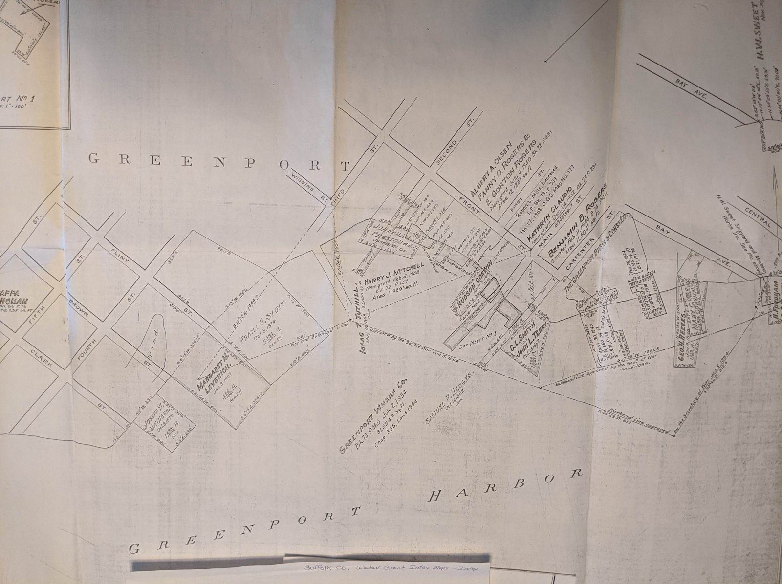
Nineteenth-century atlas map of Greenport village with property owners' names along the harbor
late 1800s — A village atlas sheet of Greenport, the harbor sweeping along the bottom, with the property holders of the shore written name by name — the world the postcards would soon photograph.

Keep digging

Where else to find Widow’s Hole on paper

For readers who want to go further, the cove appears — named or unmistakable — in each of these archives:

Have a map we’re missing? Old surveys, deeds and charts of this shore are exactly what this project collects. We’d be glad to add yours.
×

1887 bottom-land grant map — the pond and the Leverich parcel

×

Village atlas sheet of Greenport, late 1800s